Tell El Kebir (At Tall al Kabīr)
Tell El Kebir (التل الكبير lit."the great mound") is 110 km north-north-east of Cairo and 75 kilometres south of Port Said on the edge of the Egyptian desert at the altitude of 29 m. Administratively, it is a part of the Ismailia Governorate.
In the ancient times the city of On (modern Matariyah) mentioned in Genesis 41:45 was identified by some as located south-west of the mound, which according to the Egyptian legend was the first place where cotton was cultivated.
The location is famous for the Battle of Tell El Kebir which was fought in 1882 between the Egyptian army led by Ahmed 'Urabi and the British military. The ancient ruins of On were fortified into an entrenched camp by the Egyptian troops
Map - Tell El Kebir (At Tall al Kabīr)
Map


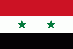
Country - United_Arab_Republic
 |
 |
| Flag of Egypt | |
The republic was led by Egyptian President Gamal Abdel Nasser. The UAR was a member of the United Arab States, a loose confederation with the Mutawakkilite Kingdom of Yemen, which was dissolved in 1961.
Currency / Language
| ISO | Currency | Symbol | Significant figures |
|---|---|---|---|
| EGP | Egyptian pound | £ or جم | 2 |
| ISO | Language |
|---|---|
| AR | Arabic language |
| EN | English language |
| FR | French language |